A Fishing Community by the Sea
"Whomever reads a map, explores a place with their mind."
These words are displayed next to two maps at the Visitors' Center in Paracas, a small fishing community on the coastline of Peru. The exhibit implies that Paracas can be best understood after studying the two maps. The topographical map shows the elevation changes of a desert plain. The nautical map shows a community affected by its location to the sea.I smile when I read the words because I have never been good at maps. I am directionally challenged and just the night before took three wrong turns at the hostel trying to find the kitchen.
Maps are confusing to me. As I stare at the maps, Juan Carlos, our tour guide, moves us to the next exhibit.
Vamanos amigos. Come this way.
Juan Carlos met us in the lobby of the hostel at 8:00 in the morning. Our first item of the day was a boat tour of Ballestas Islands, seeing the Humboldt penguins, Peruvian boobies, Guanay cormorants and the biggest colony of sea lions in the Pacific. We passed fisherman on the water, part of the workforce that collects the largest anchovy harvest of anywhere else in the world.
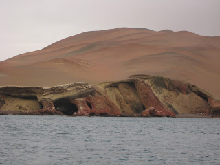
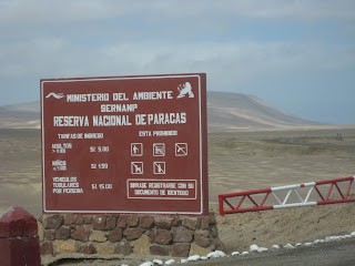
After the Visitors' Center Juan Carlos takes us on a land tour of the National Reserve of Paracas. He keeps a running dialog as we drive along the coastline of an arid desert that receives only 2 mm of rain a year. An area known for its dust storms.
Even the name speaks of the dryness.
Paracas.
The Quechuan word for
sand rain.
The place where it rains sand.
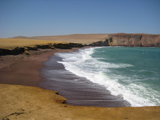
We drive on packed dirt roads through the sand dunes. Near the end of the tour, Juan Carlos takes us to a small community in a secluded bay. Rather than taking a direct route, the van swings wide, on a detour through the desert.
"This is where the tsunami came," Juan Carlos says. His voice drops low. "After the 2007 earthquake."
I am ashamed to admit I know nothing of this day when the foundations of Juan Carlos' world shook. When the scale measured 8.0 in the neighboring village of Pisco, where people died when buildings fell and the cathedral collapsed in the square at 6:40 pm on August 15th.
"Pisco had the earthquake," Juan Carlos says. He takes off his glasses and wipes them on his mustard-yellow sweatshirt. He clears his throat. "Paracas, the tsunami."
3 waves measuring 9 meters in height. The sea that fed a community, was suddenly a deadly killer.
"What did you do?" someone asks."
After the quake," Juan Carlos says, "I took my family and ran."
He ran. Juan Carlos ran.
He ran to higher ground, to a desert that rains only sand. Away from the sea and the water that pursued him.
"600 dead," he says. His eyes focus on the desert and I wonder what he sees, what memories haunt him.
And in that moment I know that a map will only allow me to explore a place in my mind, but it is the people who live here that allow me to explore a place with my heart, because I have never fled from a tsunami, but I know what it is like to have a world collapse and the foundations crumble and to wonder if I will drown in the overwhelmedness of it all.
And you have too.
But this is the lesson no map will teach me.
Juan Carlos ran.
I heard it from his own lips.
He ran when the earth shook and the waters came.
And I have run. And you have run. And the story could end here.
But it doesn't.
Because all day long Juan Carlos has shown me evidence of a community that has rebuilt after the unthinkable. He came back and others came back. And this is the lesson I want to explore in this fishing village by the sea because when foundations crumble, it's not so important to know which way is north, but it is imperative to know the way back home and Juan Carlos seems to have found it.